Wednesday 9 December 2009

Skills Books...

The skills books that I've mentioned are:

AQA Geography Skills - book written specificially for our course, covering GEOG2 (AS) and GEO4a (A2).

and Essential Geographical Skills - a general skills book covering a range of graphical, statistical, cartographic and fieldwork skills...

I've just noticed that there are also guides for GEOG1 and GEOG3 available in the same series as the first book - I've not got copies of them yet, so can't say how useful (or otherwise) they are.

Monday 23 November 2009

Wales...

Year 12....

Wales is Monday 22nd to Friday 26th March.

The cost will be confirmed asap, but you need to get your permission slips and deposits (£20) in as soon as you can please!

Click on label below for more about Wales from previous years....

Update... (2)

Lots of plate tectonics work for Year 13 in the first few weeks of term - plate tectonics theory, evidence for the theory of continental drift, structure of the earth, locations of the major tectonic plates, types of plate boundary, and how plate boundaries affect volcanic activity.

We've also spent a long time working on fieldwork investigations in preparation for GEO4A in January. Look at the previous post if you need a reminder of the enquiry structure (you shouldn't!). The majority of the paper will be focused on your fieldwork enquiry, so you need to make sure that you know your investigation inside out. There will also be some questions based on secondary fieldwork data, and it might be that you have to do some calculations as well as interpreting and analysing the data.... Make sure that you have a look back at Spearman Rank and know how to calculate Rs values (AND test their statistical significance!). We will have a look at Mann-Whitney and Chi-Squared in the next couple of weeks.

Most of the Year 13 group also enjoyed a trip down to "the big smoke" just before half-term. Although it was a pleasant morning considering, the layby and the school minibus are not necessarily a welcome sight at 6am. A sleepy trip down the M1 and we were at Stanmore, and then - after an impressively quick assessment of the Tube map - it was the Jubilee Line to South Kensington (an opportunity for Miss Breider to do the SuDoku, Jonny to do the crossword, Myles to catch up on the news, Michael to collect some McDonald's vouchers, and Ellie to do her make-up), and then a v speedy walk to the Royal Geographical Society. There were a number of interesting lectures (although, admittedly, some of them might have been more appreciated had we not been up so early...) and some good advice about Geography at university. Before we left, we had a chance to explore the Map Room, and we tiptoed through the Fellows' Tea Room so that we could have our photo taken in front of the rather lovely perspex globe. (A shame Jonny felt it necessary to block the view of the lovely perspex globe...)


We made the most of our venture 'down south' with a trip to the Red Zone of the Natural History Museum, where we experienced the Kobe earthquake first hand, looked into the structure of the Earth in a bit more detail, and saw some of the rocks and 'spun sugar' produced by the eruption of Mount Saint Helen's in 1980.

Update.... (1)

Lots to catch up on as it has been a busy few weeks...

After spending the first few weeks of term getting to grips with the hydrological cycle and river processes, it was off to Dovedale for Year 12. Fortunately this time, it wasn't the morning after a Sixth Form Party, but the weather when we arrived at our first site was thoroughly grey and miserable, and the fog made it pretty difficult to see the nice v-shaped valley and interlocking spurs. Luckily, things improved as the day went on, and we almost had some sunshine when we got to Site 3. We measured a number of variables at each site - channel width and depth, velocity, gradient of the long profile, and size and angularity of bedload, with the aim of understanding how these variables changed with distance downstream. After lunch (and all those gates) we arrived at Milldale, from where we walked down Dovedale to the famous stepping stones, stopping to look at a variety of interesting geographical and geological features along the way, including Ilam Rock, the Tissingon Spires, Thorpe Cloud and Lover's Leap (although I was disappointed with the response that my rendition of the Lover's Leap legend received...). The highlight of the day, of course, was the ice cream...

For more about Dovedale, including various links, click on the label at the bottom of this post.

Since our return from Doevdale, we've spent a lot of lesson time writing up our findings in preparation for the GEOG2 exam in January. You should, by now, be very familiar with the enquiry structure:

- Aims (what you were trying to find out)
- Hypotheses (predictions of what you expected to find - with some theory to back them up!)
- Method (what you did - remember, your method should be clear enough that someone who knows nothing about what you were doing could replicate your investigation)
- Results (maps, graphs, tables, statistics, etc. - presentation of your findings)
- Analysis (discussion of the results of your investigation... make sure that you link back to your hypotheses)
- Conclusion (a summary of your findings - link back to your aims and hypotheses... Make sure that you are not saying anything new in this section!)
- Evaluation (what was successful about your investigation, what was less successful - and how could those problems have been resolved, how could you extend/develop the investigation?)

We also had to make sure that we considered the risks that we faced, and it might well be that you are asked about risk assessment in your GEOG2 exam.

Friday 2 October 2009

RGS Learning & Leading Gap Year Scholarships

The Gap Year scholarships that I mentioned this morning are offered by the RGS. You need to be planning to do something geographical in terms of further study, and commit to being an RGS Ambassador (visiting schools and talking to students about Geography and why it's so fab!)... Scholarships of up to £4000 available!

More info here but if you think that you might want to apply for this, you need to get a wriggle on as the application deadline is 18th October.

Global Fellowship...

Will add posts over the weekend as a reminder of the lessons of the last week or so, but just been reading about the Global Fellowship programme that we talked about this morning.

I can't see the details of the application process as you have to register first, but there is lots of information on the website, and the more I read about it, the more I think it sounds like a fantastic opportunity and that some - or all - of you should apply!

The website is here and the deadline for applications is 18th December 2009.

Give me a shout if you decide that you want to apply and need a reference. Also, pass the details on to anyone else you think might be interested - non-geographers welcome too!

Tuesday 15 September 2009

Year 13

After spending our first lesson back reminding ourselves about the structure of the A2 course, analysing the AS results, achieving slightly better marks in the Summer GeoNews Quiz than Year 12 did, we spent Friday's lesson looking at progress with projects.

Remember that you should, by now, have a plan together of what you are doing and when - regardless of whether you are replanning a new investigation, or are about to start writing up your project. We will spend Friday lessons on project work, but we need to make sure that write-ups are finished by mid-November so that we have time to get plenty of practice of exam questions in before your exam in January.

This morning's lesson was an intro to Plate Tectonics - and a reminder that you need to be keeping an eye on the news so that you have an up-to-date knowledge of what's going on in the world, and some "golden nuggets" to incorporate into those essays you'll be writing.

Homework, for when I see you on Tuesday next week (I said Thursday initially - but it's Stop the Clock Day, and Friday is project work) - is to find out about Alfred Wegener... Who was he? When was he around? What did he do/say?

Year 12 - Drainage Basin Hydrological Cycle

Once we had looked at the structure of the course, and what you need to be doing in terms of reading, notes, organisation, etc., on Wednesday, we had a look at some key hydrological cycle terms.

Thursday's lesson was then spent looking at the systems approach, the idea of open (eg the drainage basin hydrological cycle) and closed systems (eg the global hydrological cycle), a recap of the features of a drainage basin. We then had a more detailed look at the drainage basin hydrological cycle, and you began putting together your hydrological cycle flow charts.

I've spent some time this afternoon marking these, and the exam question you did, and I am pretty impressed on the whole (not least with the fact that all of them were handed in on time!). We will start tomorrow's lesson with a quick look at those.

Welcome/welcome back!

Apologies for the fact that the first post of the year comes a week into the new term... but welcome back to Year 13, and welcome to the new Year 12 group.

Make sure that you visit the blog regularly - summaries of lessons will be posted here, together with resources, websites, news stories and other interesting bits and pieces.

Your first interesting website is this one - a set of podcasts from the NERC on a variety of topics...

Saturday 11 July 2009

London Fieldwork Summer School

I mentioned to you last week about the fantastic London Fieldwork Summer School opportunity that the RGS are offering for students who are thinking of applying for Geography courses at university... There are still places available - more details here.

Saturday 4 July 2009

Study Geography

Thought that as you are starting to think about your UCAS applications, and some of you are considering Geography at university, it would be a good idea to remind you about the RGS Study Geography site - lots of useful information about why Geography is a such a good subject choice and possible careers, how to choose a course, completing your application, etc. Click on the picture below to link to the site.

Thursday 2 July 2009

Quarry or not?

The official video from Tuesday is here, with Simon taking a starring role!


I've also downloaded the official BGS photos from the day, and they are in the folder in Student Share, together with my pictures that we looked at this morning.

Tuesday 30 June 2009

Quarry....

...was the verdict of the planning inspectors today!

Not had a look at the photos yet as I can't find my camera cable and have been busy exam marking. But, I really enjoyed today - I thought that you looked very smart, conducted yourselves very well (apart from trying to make them interview me again...), were knowledgeable and articulate, and I was very proud of you! You definitely held your own! Hopefully you enjoyed the day from a Geography point of view, as well as a "making new friends" (Jo!) point of view and a "three lots of lunch" point of view (boys!).

Keep an eye out for some pics in the next couple of days. In the meantime, very well done!

Thursday 25 June 2009

Quarry or Not?

Thank you to those of you who have returned money and permission slips for Tuesday. If you haven't, you need to do so as soon as possible please.

Don't forget to have a look through the Stakeholder Terms of Reference that I gave you this morning, and also the Environmental Statement that is saved in Share and I will email to you tomorrow. Jo and Michael, you will need to collect the ToR for your roles at some point so you have chance to have a look at them before Tuesday.

Please remember:

- smart dress (not necessarily a suit, although there'd be nothing wrong with that... but not jeans either).

- we need to leave school at 8.30am (not start arriving at school at 8.30am!) - I will let you know on Monday morning where we will need to meet.

- you will need to bring your ToR, etc. with you, and writing implements might be of use. If you want to bring a camera, that is fine, but remember that cameras, mobile phones (which will obviously be turned off during the time that we're at the BGS), and anything else that you choose to bring with you will be your responsibility for the duration of the visit.

- lunch and refreshments will be provided by the BGS.

Projects...

Apologies that I forgot to take in your plans this morning - I will have them in on Monday from everyone please!

Dos and don'ts of questionnaire planning and execution this morning... You demonstrated that you know the "right" answers; your task now is to apply them in the questionnaire that you are planning (either linked to school transport, or something that is directly related - and therefore could be used as your pilot - for your own investigation). By Thursday morning, your questionnaire needs to have been written and carried out - you will be analysing your results and then evaluating your questionnaire on Thursday, so if you don't have any results, you will be in something of a mess.

Monday we will look at locations, maps, and get those action plans sorted.

Oh... and this is Survey Monkey!!

Thursday 18 June 2009

Quarry or Not?

To save you having to search back through old posts, here is the post from the Quarry or Not? event at the BGS last year...

And the official video from the event...


Don't forget please, permission slips, money and photographic consent forms back to me as soon as possible please!

Monday 15 June 2009

Welcome back Year 12!

This morning, in our first lesson after the exams, we looked at the structure of the A2 course, and talked about the new A* grade...

Remember, the specification is here, and you can also access sample questions, etc. on the AQA website. The ppt from this morning's lesson is in a new folder in Student Share, and you have a copy via email too.

We then went on to look at GEOG4A - the individual fieldwork investigation, and after we'd talked about the process of planning and carrying out an enquiry, you started to think about topics that you might be interesting in investigating.

We will spend Thursday's lesson (p1) continuing to discuss topics and investigation ideas, and then on Monday you will need to be ready to present your initial proposal to the rest of the group, and to hand in one side of A4 outlining your intentions. Don't forget to talk to people at home (who are likely to need to be roped into helping you collect your data!) and have a chat to the Year 13 geographers too...

Tuesday 26 May 2009

GeoTube

Meant to post about this ages ago but don't think I ever did!! GeoTube is a collection of geography related videos from YouTube and other such places, and although primarily aimed at Geography teachers, there is lots of really useful stuff on there so if you fancy a change from reading through your notes and essay practice, have a look!!

Tuesday 12 May 2009

Geomorphological Hazards...

The BGS "report an earthquake" page that we mentioned but couldn't find in the lesson is here: BGS - Have you felt an earthquake?

The BGS also has a rather nice education booklet (although it is less nice because it is in Comic Sans... BGS - Earthquake Education Booklet and excellent landslide case study resource - well worth a look, especially as we didn't spend an awful lot of time on landslides. Landslide case studies

A reminder about the Italy and China earthquake links that you have on your handouts:

Italy earthquake - BGS report

Italy earthquake interactive map (BBC) (as always with the BBC - check out the links to related stories on the right hand side too)
How the Italy earthquake happened BBC video clip
(and links from there to lots of other video clips)
The Big Picture


China Earthquake In Depth (BBC)
One Year On - Special Coverage (China Daily)
China Earthquake One Year On (National Geographic)
Recent report about tourism in Sichuan Province (synoptic!!)

Monday 27 April 2009

Revision Guides.... again!

Another reminder for Yr12 and for those of you in Yr13 who are resitting AS modules, that the revision guides that I wrote at Christmas are all here. The Population and Rivers ones, although written for the old specification should be useful for Yr12 too.

I have also just added a Cold Environments Revision Guide, written by Rob Chambers, who is a Geography teacher in Cambridge. Although it is specifically written for AS, it is also of use to Yr13. There is some stuff at the beginning that is specific to Rob's school but you can just ignore that bit!

The password is Ben's geographical nickname... If you can't remember, ask me at school, email, or ask one of the Yr13s.

Friday 10 April 2009

The Places We Live

Just come across this superb site exploring 4 of the world's slums, including Dharavi:

Thursday 9 April 2009

Antarctic Treaty

Thanks to Tony Cassidy for pointing out this Costing the Earth episode about the Antarctic Treaty - useful listening for both Yr12 who will be looking at this after the holidays and Yr13 as revision...

Yr13 - Tectonics

We started Wednesday's lesson with a reminder about the structure of the earth... We talked about Mr Ogden's biro experiment (but didn't risk setting fire to the Maths Block...). We recapped the different types of plate boundaries that you had looked at while I was in Wales, the processes occurring at each, and the landforms that result.

We then watched the Volcanoes episode of Power of the Planet, where Iain Stewart visited, amongst other places, Erta Ale in Ethiopia ("the first time you're gonna abseil, you kinda didn't want it to be into an active volcano"!) and Thingvellir in Iceland.

We finished with a discussion about the theory of hotspots - still somewhat controversial, but the most commonly accepted explanation for the formation of volcanic islands such as Hawaii, well away from plate boundaries.

Yr13 - Cities

Some nice presentations on Tuesday about Urban Development Corporations, City Challenge and some of the more recent regeneration initiatives such as Sustainable Communities. Check back to the previous post on this for some links, etc. if you need to check details.

On Thursday, we started to look at the LEDW case - we started by brainstorming our perceptions of shanty towns, based on the work you did last year, and on what we "know" from the media, etc.. We then had a look at Dharavi, the Mumbai slum where Slumdog Millionaire was filmed, and talked about whether we thought it was a "slum of hope" or a "slum of despair".

The links to the photos, etc. we looked at are here:

Audio slideshow from The Guardian
Images from the National Geographic
BBC Interactive Tour of Dharavi

There are various clips on YouTube that are worth a look too...

After the holidays, we will have a look at the plans for the redevelopment of Dharavi...

Yr 12 - The Inuit

Double lesson before the holidays was spent looking at the Inuit people.

Various links here which will remind you about the distribution of Inuit people, their traditional way of life, and how their lives have changed.

Inuit Communities (in our least favourite font, sorry Laura - but some good info)
Canada's Arctic
Inuit Culture, Traditions and History

The Inuit (this one is a portal linking to lots of different sites including the Nunavut Government, various maps, and a site about Inuit games!)

We also watched the second (Baffin Island) episode of Billy Connolly's fab Journey to the Edge of the World series. The ITV pages for the series are here and have a variety of photos, video clips, etc. and a map of the journey.

Some fab photos on Flickr too, including this one from Gattou/Lucie/In and Out...

Tuesday 7 April 2009

Revision Guides

Proper posts with reminders about what we covered in the last week of term will be here tomorrow.

In the meantime, however, a reminder about the revision guides that I put together at Christmas... Although they were written for resits for the old spec (ie the one that Yr13 are doing at the moment), much of the Population, Settlement and Rivers stuff will be of use to Yr12 too.

They are here and the password is Ben's geographical nickname (email if you can't remember!).

I hope to be able to get some more stuff together in the next few days, esp Cold Environments - will add to 4shared and post here, if and when it's complete.

You might also like to check out the couple of revision bits that I have put on GeogtasticGCSE as well - the ideas could easily be adapted, so if you fancy putting together some mobile phone revision quizzes (or perhaps "flashcards" of key words?) or Xtranormal videos, send them to me and I'll put them here so everyone can use them.

Saturday 4 April 2009

Mt Redoubt

Although the alert level has been reduced, there's ongoing Mt Redoubt activity... And a fantastic panoramic image (view full size):


Earthquake in Indonesia

Just seen on the BBC website that there has been a magnitude 6.5 earthquake in Northern Indonesia... (Pacific Ring of Fire... look at your plate boundaries maps Yr13!) Fortunately no reports of casualties or damage so far.

Strong quake hits North Indonesia

In the footsteps of Shackleton

In 1908, Ernest Shackleton and his team set off to explore the Antarctic "terra incognita"... Towards the end of last year, some of their descendants embarked on an expedition to retrace Shackleton's footsteps.

There is a nice arcticle and video clips from the BBC here and their expedition is the subject of this evening's Timewatch at 8.40pm on BBC2. Will be well worth a watch for Cold Environments!

Saturday 28 March 2009

North Wales...

I'm pleased to report that the weather forecast for North Wales for the past few days was wrong, and although it was a bit cold and windy, we saw very little in the way of precipitation!

Plenty of good photos - many of which demonstrate Yr12's ability to pull strange faces... We'll look at them properly next week, but here are a few:


Cwm Idwal
View from Clogwyn Station


View down the Llanberis valley from Pen-y-Pass (no hail in this pic!)

The Conwy estuary and Llandudno from Conwy Mountain (see what you missed out on!!)


It was a great few days - you worked very hard, asked lots of good questions, and provided plenty of entertainment.

Norfolk Coast

Currently exploring the Norfolk Coast blog - some lovely photos and lots of good geography!

Saturday 21 March 2009

Yr13 - Tectonics

Those of us who were here on Wednesday reminded ourselves about the structure of the earth and talked about plate tectonics theory.

You then put some nice maps together showing the major tectonic plates and the directions in which they are moving.

For the next time I see you, you need to be finding out about the main types of plate margin:

Destructive (convergent) - oceanic/oceanic, oceanic/continental, continental/continental

Constructive (divergent)

Conservative

For each, you need to be thinking about processes and landforms, you need a named/located example, and you need a diagram.

You might also like to check out the post on Geogtastic about Hunga Ha'apai, the underwater volcano near Tonga that erupted earlier in the week - some spectacular photos about, and also check out the Smithsonian Global Vulcanism and USGS Earthquake Monitoring overlays in Google Earth.

Yr13 - Inner Cities

Housing issues on Tuesday - the Prezi is here and this is the article from The Guardian that I gave you copies of. We also had a look at Val Vannet's writing about the Dundee tenements that she passed regularly on her way to work, and how the area has changed.

For the next time I see you, on Tuesday 31st March, your groups need to be ready with presentations on UDCs, City Challenge, and the 21st century inner city initiatives such as "sustainable communities".

There are lots of links on Geography Pages that might be of use to you, particularly in the GCSE Settlement section.

Also:

Urban Development Corporations
City Challenge Partnerships Evaluation
The Sustainable Communities Plan

Yr12 Cold Environments

Periglaciation this week - discussion of what "periglacial" means, climate of periglacial areas (and a climate graph for Svalbard, which I should have from all of you by now), permafrost, periglacial processes (freezing/thawing of permafrost, frost-heave, nivation, freeze-thaw weathering). On Monday, we'll have a look at periglacial landforms.

As ever, click on the tags at the bottom of the post to link to previous posts about periglaciation, links, etc.

Tuesday 10 March 2009

Yr12 - GIS and Health

Last Thursday, we had a look at GIS and this site which allows you to investigate a variety of indicators related to health and quality of life, to compare these indicators by area, and to create health profiles for particular areas.

Don't forget that you need to be completing the worksheet for me for this Thursday (p1).

Yr12 Cold Environments

Whilst I was off, you were researching and putting together a timeline and an annotated map showing the human activity in Antarctica. I now have that work from most of you, but there are still a few who didn't manage to find their way to the Humanities Block before the end of schoool today, and I am not very happy about that.

You also should have spent some time checking that you had thorough notes about each of the glacial landforms we mentioned (U-shaped valleys/glacial troughs, ribbon lakes, corries, aretes, pyramidal peaks, roche moutonnees and drumlins).

Yesterday, we looked at fluvioglaciation - processes and landforms caused by glacial meltwater. The photos we looked at at the start of the lesson were of Skeidarasandur - lots more on Flickr and it is worth a quick search to find out a bit more about the jokulhlaups that we mentioned.

For Tuesday next week (to Mrs Chambers), I asked you to describe and explain the landforms that you would expect to find in a fluvioglacial landscape. (You should be including outwash plains, braided streams, eskers and beaded eskers, kames and kame terraces, kettle holes, diverted drainage and proglacial lakes.)

Yr13 - Cities

You should, today, have handed in your work using the Neighbourhood Statistics site and the Derby City Partnership site. Thank you to those of you who did - if you are one of the people who didn't, you know what you need to do...

We spent Thursday's lesson mapping the best and worst places to live in the UK (according to Phil and Kirstie) and we spent the first part of today's lesson talking about the patterns that the maps showed and the possible reasons for this.

We then went on to think about the causes of inner city decline, and discussed some of the problems of inner city areas and how they've come about, and the cycle of deprivation. Don't forget though, that I also gave you a piece of writing by Tony Cassidy, a geography teacher who lives in inner city Nottingham - an interesting alternative perspective.

Linking back to the Bradford work that we did recently, you might be interested to know that the Westfield development has been "put on ice" according to an article in the Telegraph & Argus. Unsurprisingly, there have been plenty of letters in response to the news, and if you search for "westfield" on the T&A website, you can look at those, as well as a number of other related articles. The "Bradford Metropolitan District Council, Pull Your Finger Out" group on Facebook is also worth a look!

Yr13 - Coasts

Last Wednesday we spent quite a lot of time looking at three coastal management case studies - copies of the work that you produced tomorrow.

I also asked you to find out about coastal barrages - what they are, how they work, and an example (Cardiff Bay Barrage is one example you could use). I also asked you to think about the proposals for the Severn Barrage, and be prepared to tell me tomorrow whether or not you think it should go ahead.

Sorry!!!

Apologies for the lack of updates recently... Busy busy!!

Tuesday 3 March 2009

Coastal Management Links

Isle of Wight (mainly hard engineering)
Isle of Wight Centre for the Coastal Environment
Medina Valley Field Centre


Netherlands (large scale scheme)
Delta Works Online
Coastal Guide (use search function - Netherlands)

Sefton Coast, NW England (small scale scheme)
Sands of Time
Sefton Coast Partnership

Tuesday 3 February 2009

I need a name please...

Yr12 - Glacial Movement, Erosion and Glacial Landforms

A reminder at the start of Monday's lesson about glaciers as systems, anatomy of a glacier, etc. and also recap of thermal regimes(!). We then looked at different ways in which glaciers move, formation of crevasses, and then processes of erosion.

You then began to look at various glacial erosional and depositional landforms. Remember that for next Monday, you need to be ready to teach the rest of the group about your landform or landforms, including:

- description
- process of formation
- alternative names
- examples (located)
- photographs, and OS maps

If you need any resources, or any help, let me know BEFORE the weekend...

North Norfolk Coast SMP DME - Yr13

Coastal Concern Action Group for Happisburgh

EDP 24 (Norfolk News and Property Search)

North Norfolk District Council

DEFRA Flooding and Coastal Erosion

Environment Agency - Managing the Coast

Sunday 25 January 2009

Yr13 - Bradford Regeneration Part 2

Some of the photos from the Bradford trip still need titles/detail adding, but they're here if you want to look at the ones we didn't see on Tuesday. A couple of videos taken with my new Flip video camera here though...

This is Centenary Square, in front of City Hall - and this will be the site of the "Park at the Heart":

Centenary Square in Bradford from victoria ellis on Vimeo.

I have to say that, having been there this morning, the park idea doesn't seem quite so far-fetched, and it wasn't so hard to imagine a hot summer's afternoon with music playing and people sitting outside various bars and cafes.... who knows?!

I didn't feel quite so positive about the proposed Westfield development, however:


Westfield Bradford from victoria ellis on Vimeo.

More about Westfield and the vision for Bradford, complete with a "flythrough" of what the centre will look like here.

Yr13 - Bradford Regeneration Part 1

Following on from the work you've been doing looking at possibilities for regeneration in Bradford, we spent Thursday's lesson finding out more about the actual plans...

The video we looked at with Will Alsop's Masterplan is here:


And the "streetsweeper one" (which I understand better now, thanks to Joel!) is here:


Should you not have heard enough of Linda Barker the other day, you can also watch the Building Britain programme, which looked at plans for the regeneration of Bradford, and compared them with how Leeds has developed in recent years, on YouTube...

Yr12 - Cold Environments Introduction

Last Monday, we started to look at Cold Environments... After a discussion about what we mean by "cold environments" (particularly glacial and periglacial areas, and areas such as Snowdonia that were glaciated previously), and a think about why some places are colder than others, we talked about types of glacier. You should (unless you are Myles who has sent it already) have a piece of work ready for me with an example of each type of glacier, and a photo....

Wednesday 21 January 2009

Yr13 - Long-term sea level change

The website that we discovered this morning was BBC Scotland's Geography pages. The link to the sea level change resources is here, but there are plenty of other useful and interesting things on there as well...


Make sure that you have explanations of fjords, rias, raised beaches and relict cliffs, together with an example and a photograph of each... I would like a copy by email please, and you need to print yourself a copy out to go into your notes.

If you want to have a play with the sea level change in Google Earth, the instructions are in the ppt (in Student Share) and you could also investigate Noel Jenkins' Sea Level Change in Australia resources.

Monday 19 January 2009

Year 13 - Sustainable Cities

Found this video last week but forgot about it so thanks to Rebecca Annis for the reminder... Well worth a watch, and you might find some interesting ideas to incorporate into your plans for Bradford...

Year 12 - Introduction to Cold Environments

A couple of links that will be useful for you:

Some excellent pictures from Keele University here, and worth checking out Peter G. Knight's glacier pages...

Don't forget that if you click on the cold environments label at the bottom of this post, it will bring up all the posts from when Yr13 studied Cold Environments before Christmas.

Sunday 18 January 2009

You, Me and the Climate...

Do you care about climate change? Do you want to make a difference?

If so, check out You, Me and the Climate and become a Climateer! The National Trust are recruiting 16-19 year olds to join a network of young people to lead climate change projects in their local communities...


Sounds like a great opportunity not only to make a difference to your local community, but also to learn new things, meet new people and will look good on application forms and CVs as well! Have a look at the website for more information, application forms, etc. and if you want some help with your application, come and see me.

Thanks to John Barlow for pointing this out.

Make yourself some revision cards!

Just put this together in less than 5 minutes using the Trading Card Maker from Big Huge Labs and one of my Flickr photos... Your finished trading card is a jpeg file, so you can print them out easily as small cards or full pages - make yourself a set of case study revision cards!

Better still, make yourself a set and upload them to Flickr so that other people can use them too!

Friday 16 January 2009

A mystery for you...

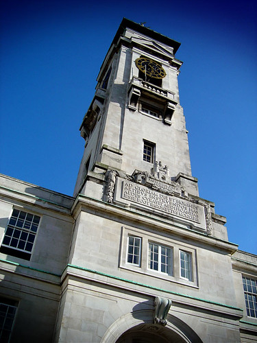
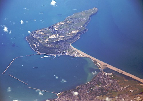
What connects Nottingham University's Trent Building with the Isle of Portland in Dorset, and a recent news story?

Image - Flickr user Toxophilite (CC)

Image - Flickr user Sharkbait (CC)


Click here to find out more from the Times Online...

Wednesday 14 January 2009

Year 13 - Coastal Processes and Landforms

A quick recap this morning of the main processes affecting the coastline (various processes of erosion, sub-aerial processes...), how geology affects rates of erosion, and then various erosional and depositional landforms that you need to be familiar with:

- headlands and bays
- caves, blowholes, geos, arches, stacks, stumps
- wave-cut notches and platforms

- beaches (storm beaches, berms, ridges, runnels, cusps, ripples)
- spits, bars and tombolos

Some nice sketch maps of the key landforms of the Holderness Coast and the Jurassic Coast, a discussion about whether Chesil Beach was a bar or a tombolo, and the some short-answer exam questions - don't forget that if you have time before next Wednesday, that it would be useful for you to have had a go at marking your questions.

My photos that we looked at of the Flamborough area and of the Jurassic Coast are all on Flickr - not brilliant pictures, but should serve as a bit of a reminder of the landforms and features that we talked about this morning.

Monday 12 January 2009

Year 13 - Tuesday

Below are links to various resources that we used in yesterday's lesson, and also the Urban Redevelopment Corporation.

Urbed

Urbed Design Guide

Bradford URC

City Centre Map

All of the photos that we looked at were from Flickr - a search for "bradford" or "west yorkshire" will bring up lots of excellent images for you to look at.

Your task, which you will be continuing with tomorrow (and probably on Tuesday) and which will be due in from everyone on Tuesday 27th January, is to come up with a plan for the redesign of the city centre. Your finished piece of work can be presented in whatever way you wish, but should include an annnotated map showing the key features of your plan.

You need to make sure that you are considering the issues and challenges that we talked about at the start of the lesson that are specific to Bradford, as well as the more general problems of CBD decline, and thinking about how to address these...

Have fun!

Sunday 11 January 2009

Good luck!

A quick message for Year 12 and for those of you in Year 13 who are doing resits tomorrow...

Image - Flickr user Mrelia (CC)


GOOD LUCK!!!!


Oh, and read the questions properly and answer what you're asked!!

Wednesday 7 January 2009

Yr13 - Wednesday

Reminder about some of the coasts work that we started before the summer:

The Coast as a System
Waves
Tides
Sediment Cells
High and Low Energy Coastlines
Concordant/Discordant Coastlines
Erosional landforms (especially those wave-cut platforms!)
Depositional Landforms
Landforms related to sea level change

And the best news of all.... Coursework is packaged up and gone!!! Well done!!!!!

Yr13 - Tuesday

The increase in world population and the reasons for it in Miss Bradford's lesson... And don't forget that important WHO statistic that you finished the lesson with!

We then looked at cities and considered the issues and challenges that face cities today - those in MEDCs, those in LEDCs, and those that are common to both.

Dan's Urban Earth videos are here http://www.urbanearth.co.uk. And if you liked the Urban Earth idea, you might like to check out Noel's Rural Earth... Maybe we should be making a Semi-Rural Earth one - get planning a route!

We also started to look at the CBD and the key features of the CBD. We will continue this tomorrow, and consider what is happening to many CBDs.

Year 12

The first part of Monday's lesson was spent discussing the fieldwork section of the Unit 2 exam that you will be sitting on Monday morning. Remember that you can access some of the sample questions on the AQA website... If you know your fieldwork investigation thoroughly, then this section should be very straightforward - and there is no reason why you can't answer the fieldwork section first, even though it will not be the first question in the exam booklet.

We then revised some of the key rivers ideas - the drainage basin hydrological cycle, river processes and landforms, flooding and management. If you look back at previous posts on Geogtastic6 (click on the Yr12 or Rivers labels at the bottom of this post) there are various bits and pieces that will help you - and if you look at the post below this one, you will find the link to the revision guides I've put together for the Year 13s who are resitting GGA1. The two Water on the Land documents, and the Exam Command Words one, will both be of use to you. If you have forgotten the password that I gave you the other day, email, or ask one of the Yr13s.

A quick reminder about the exam:

Monday 12th January - 9.00am - 6th form block
1 hour
50 marks - 25 marks on Rivers-based OR Population-based skills questions, followed by 25 marks on your fieldwork.

Email (or leave a comment on here) if there are things you are unsure about.

And remember READ THE QUESTION!!!

Good luck!